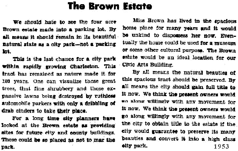
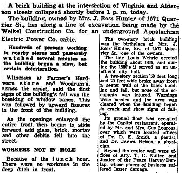
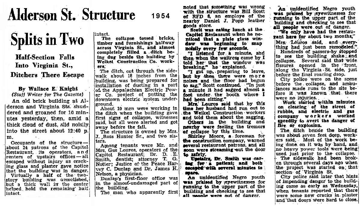
The Collapse Of The Capitol
Restaurant
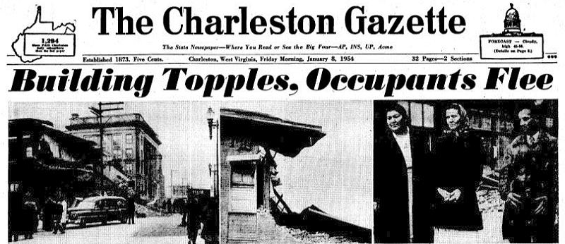
On
Jan. 7, 1954 the power company was removing overhead power lines
all over the city and burying them in the ground. At the corner
of Virginia and Alderson, (now Laidley) stood the 75 year old
brick building that housed the Capitol Restaurant. A trench was
dug on the Virginia Street side of the building which apparently
weakened the old foundation, and the building partially collapsed.
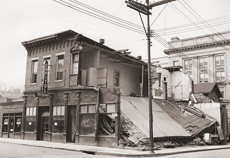
These photos
however are not so much about the collapse, but a view of the area that
is rarely seen. These unpublished photos are interesting in
their backgrounds alone.
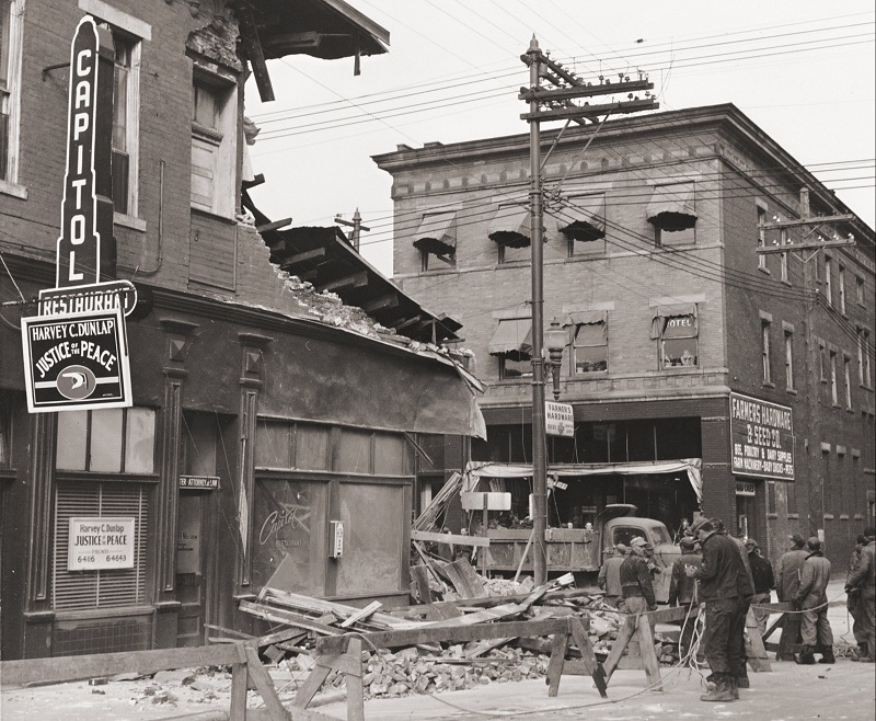
|
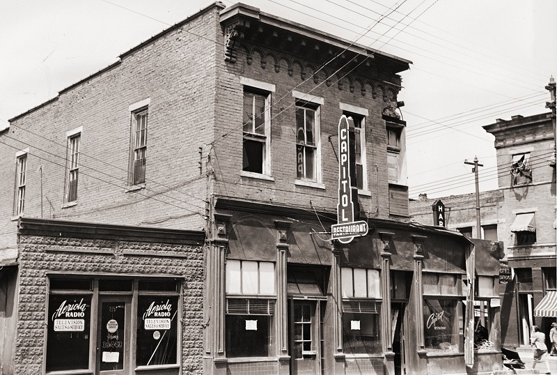
This is the
Alderson Street side of the building. (now Laidley Street)
|
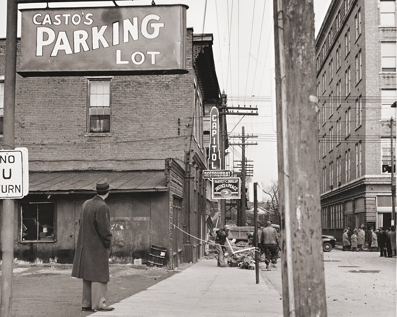
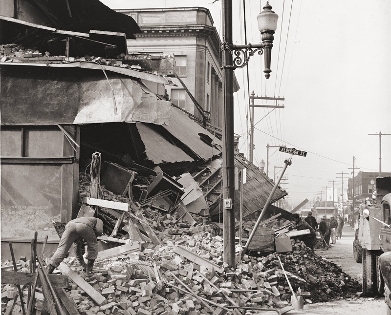
Looking
down Alderson Street. That's Woodrums on the right.
But notice the house in the background. Let's take a closer
look....
|
That
house is the old "Brown Estate" which stood on Quarrier Street and
prevented Alderson Street from meeting up with Laidley Street on
the other side. The Brown property was the last large piece of
private land in the city, and at one time was considered for a
city park. When the home was removed, it paved the way for
Alderson Street to connect to Laidley. Why the entire street was
changed to Laidley Street is anyone's guess, but probably for the
same reason that Laidley Field was named .
|
Meanwhile, back to the restaurant....
|
Another Alderson Street view
shows the Farmers Hardware at 514 Virginia Street
This corner view shows the
City Hall on the right. Notice the old house there also.
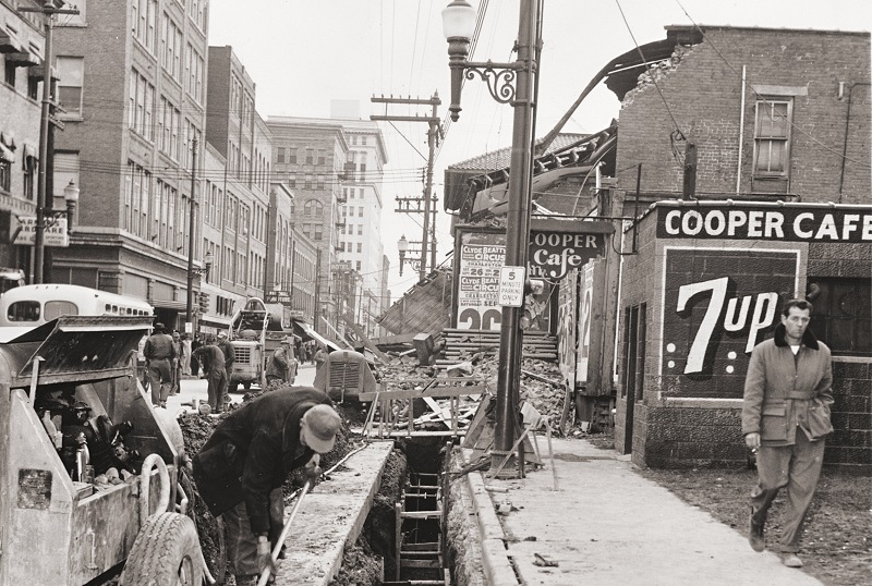
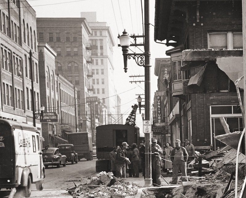
Looking
East on Virginia Street, we see Woodrums on the left, and among
other things, the old Kanawha Hotel in the background. The
Cooper Cafe was not connected to the Capitol Restaurant, but you
can see the rubble and the trench in this photo.
|
Taking
a closer look at the same scene: Now we see the old bus depot
that was on the corner of Alderson & Virginia, across from the
Capitol Restaurant. You can see an older photo of the Greyhound
Bus Depot HERE.
|
Looking
in the opposite direction, You can barely see the Municipal
Auditorium in the background.
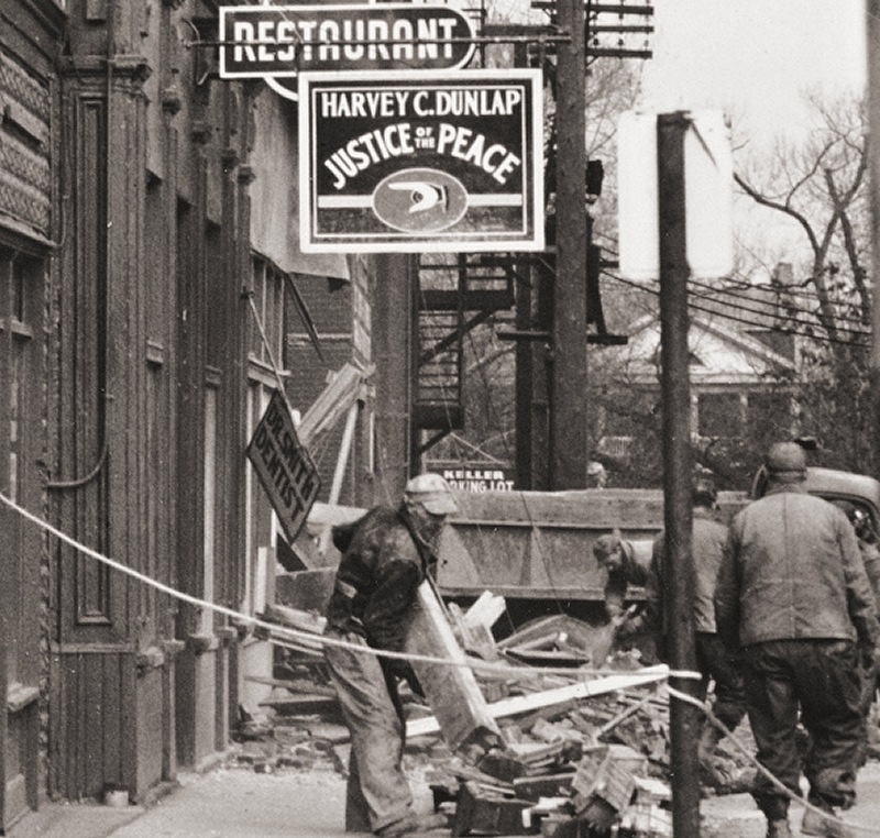
|
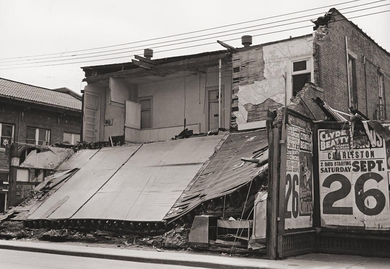
Last photo showing the wall
collapse on the Virginia Street side.
Photos courtesy of AEP

Back to Index