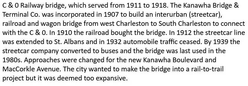
The C & O Bridge
(Formally The Charleston
Interurban RR bridge)
| The turmoil
surrounding
Charleston's bridges is a long story of which I wont go into
here. But in a nutshell, Charleston (they say) couldnt afford to build
a bridge across the Kanawha River. Private Ferry's were adequate in the
early days, but Charleston was expanding and growing fast. So
businessmen built two bridges and placed Tolls on them. The main
reason they did this was to sell land on the south side of the Kanawha.
The Toll bridges first built were the South Side Bridge and the
Kanawha City Bridge. Later, the traffic was so bad that in
order to get to this new development called South Charleston,
another bridge was needed, but once again, money was
scarce, and the taxpayers were dubious. A plan was suggested to
hang a single traffic lane onto the C&O Railroad Bridge
and make it
another Toll bridge. Since the C&O
was already charging the Trolleys to cross, why not make some extra
money, as the bridge was more than strong enough. So for the next
20 years, pedestrians, trolleys, and cars paid to cross the C
& O Railroad Bridge. |

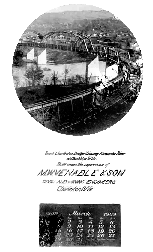
They called the C&O
Bridge "The South Charleston Bridge" at one time.
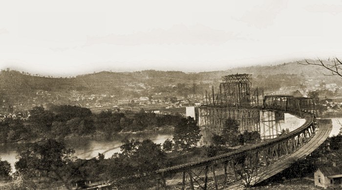
The bridge under construction in 1907.
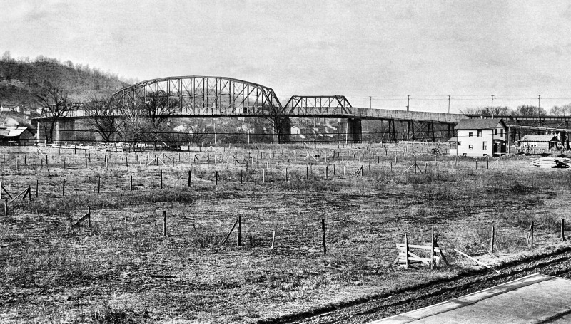
After years of searching, I FINALLY found
a photo of the bridge set-up for cars. See larger photo HERE
Here is a second photo:
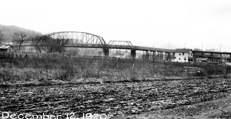
That muddy street would be 1st Ave on the
West Side. See larger photo HERE
|
*********
I always wondered
if the driver could see the river as he drove along that very
narrow VERY high road.
The answer is in these photos. Yes he could! There was nothing
but a set of cable wires separating him from the edge. Remember, the roadway was
literally hanging over the outside of the bridge! That
wall
you see in the photos was actually on the other side of the bridge's
main girders, and I believe it served two purposes: 1... to not
frighten the driver as a huge steam engine was just feet away... and
2... to prevent coal from tumbling off the top of the coal cars and
onto the roadbed OR car and driver. So now this mystery is solved.
*********
|
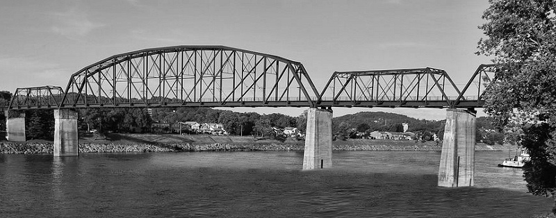
TODAY
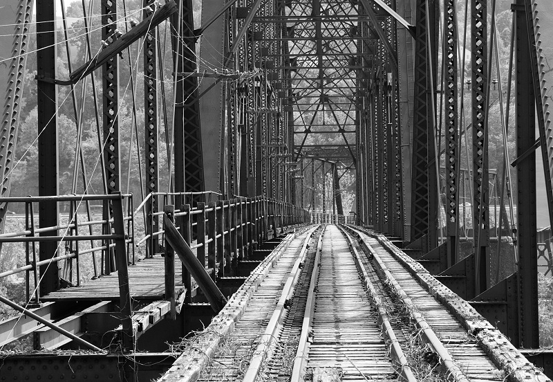
The pedestrian walkway is still visible, but the roadway to
the left in this shot was removed.
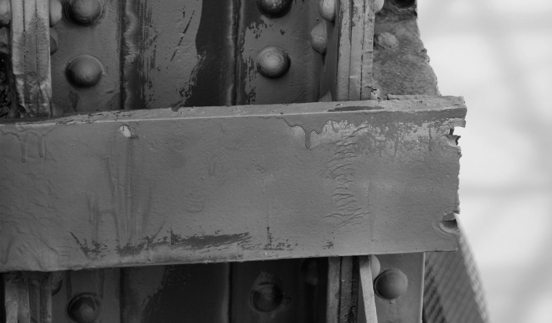
This is one of the hangers used to support
the roadway. As you can see, it's been cut off.
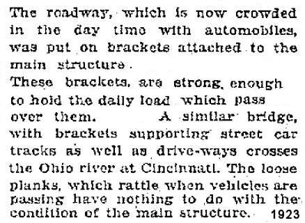
Can you imagine driving on the
OUTside of a bridge up that high? The roadway was wood and one
lane.
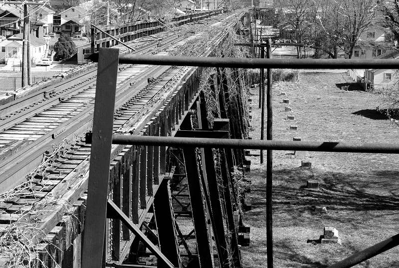
Then
you have to wonder how the cars got up on the bridge. Was there a
ramp beside the trestle? Of course, and I was fortunate
enough to have
taken this photo last year before the area was paved for the new school
parking
lot. It clearly shows the ground supports still in place (on the photos
right side) that held up the automobile ramp.
|
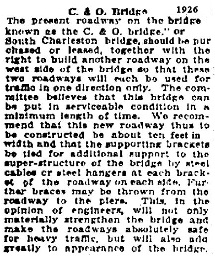
The
bridge already had one roadway, but it was a single lane. Traffic was
held up for blocks, so the city wanted to place a second roadway
on the other side of the bridge so that the traffic could flow both
ways. They also talked about buying or leasing these roadways in
order to remove the Tolls. The roadway was to be 10 feet wide.
Not much room for error that high up
|
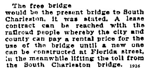
| THIS WASNT
WORKING.... and the city knew that another bridge had
to be built. As there was no Boulevard at the time, and the road
fronting the river ended pretty much at Florida Street, it was decided
to possibly lease the roadway on the bridge, whereby removing the Toll,
and building a second FREE bridge next to it on Florida Street. |
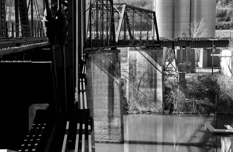
Imagine hanging off the side of this
bridge as you drive your car across on your 10 foot space....
What happened next?
| The
city finally decided that the new badly needed bridge would be
built at Patrick Street instead of Florida Street. I must assume
that they got word that the WPA was going to build the Boulevard, and
it would extend to Patrick Street thereby making a Florida Street
bridge plan null and void. So... that's exactly what
they did.... |
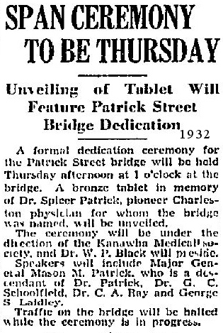
Now the citizens had a free bridge to cross.
But what about the old C & O Toll Bridge?
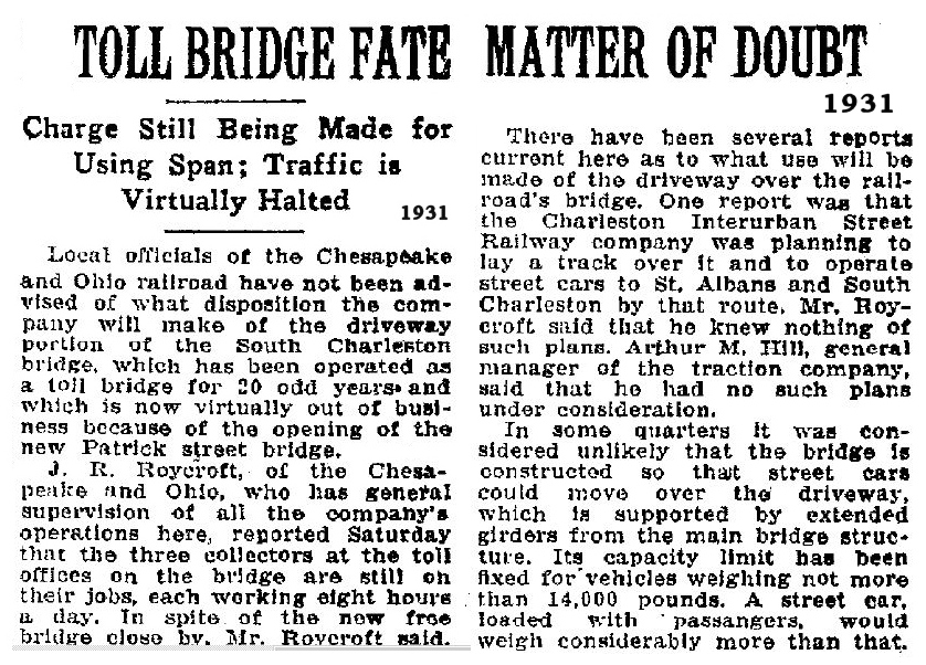
Naturally.... it died as a Toll Bridge
Now, the roadway and it's hangers were no longer needed.
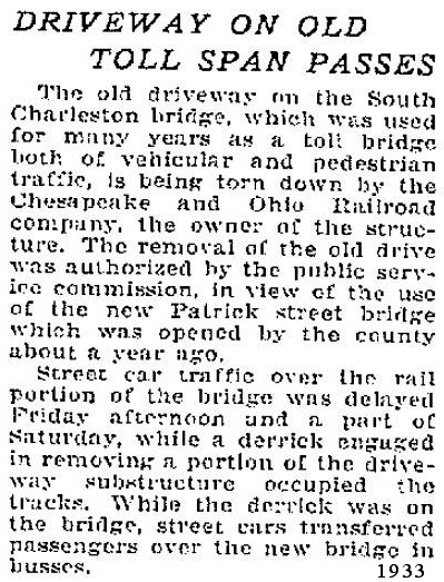
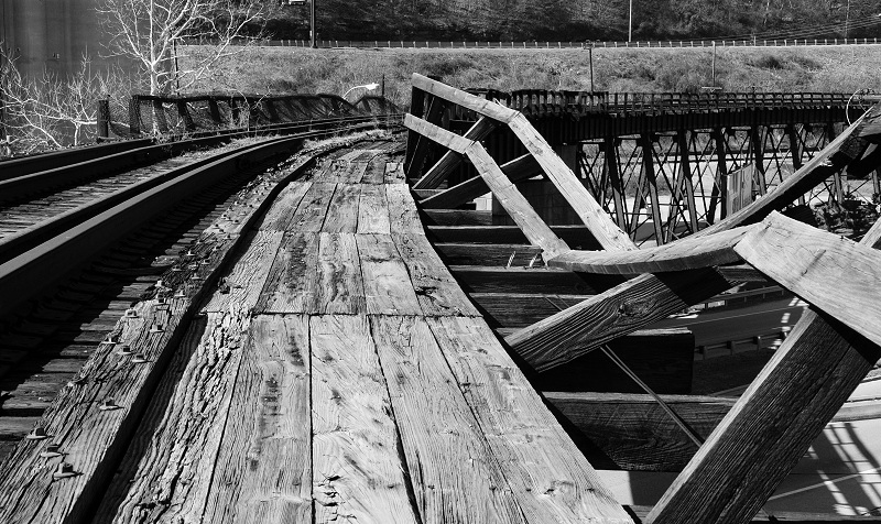
The
bridge is now in terrible shape. The legs that hold up the
trestle are rusted horribly at ground level and the superstructure
itself is in dire need of repair. It would cost much more than
it's worth to repair the bridge for any use, and in my opinion,
both ends of the bridge are places that few would want to be after
dark.... or even in daylight for that matter.
|
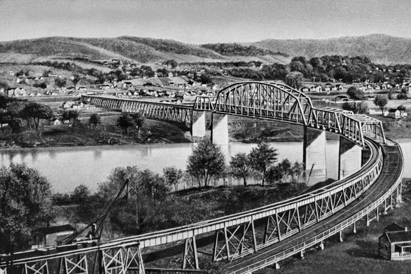
Showing the roadway coming off the South Side.
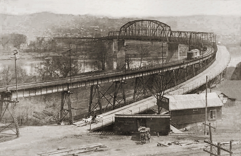
A
big "Thank You!" to Anne McClure for providing me with a batch of
old negatives that her former Father-In-Law, Henry Eary
shot... including the two photos of the old C&O Bridge shown
above. Henry took many great photos that will will find on other
pages of this website.
|
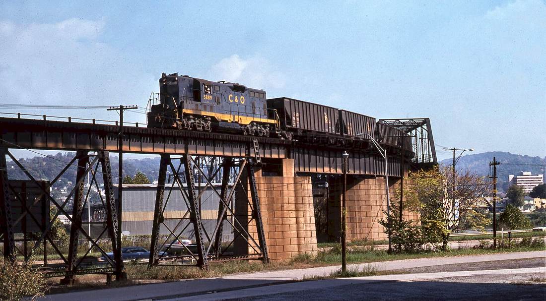
Crossing the bridge in
1975.
(Gene Huddleston photo, ca. 1975, Chesapeake and Ohio
Historical Society,

The last train to cross
in 1993.
MORE BRIDGE HISTORY By HENRY
BATTLE
The
Trestle Bridge or the CSX bridge was built by the Charleston Interurban
RR in 1907 for its full size passenger and freight (read coal!)
cars. A wooden side structure that permitted pedestrian and light
vehicular use was added, which served the local community well until
1932 when the Patrick Street Bridge opened. The Interurban RR,
heavily promoted by Gov. MacCorkle, eventually ran from Cabin Creek to
St. Albans. The same group built the Kanawha City 35th Street
Bridge in 1915 to properly accommodate both rail and automotive
traffic, perhaps unwittingly foretelling the future. When automobiles
finally did render the Interurban RR obsolete, the C&O RR acquired
the Florida Street bridge to supplement their Kanawha River crossing
farther east at Deepwater, WV. The 35th Street bridge was
converted to pure automotive use while the Florida Street bridge
remained in use by the CSX RR.
The Florida Street spans, which
had to be quite high to clear the river traffic, are steel in an arched
truss arrangement, still the standard today for such
applications. This bridge was built at the peak of the Age of
Iron & Steam, and represents that era perfectly. The great girders
are fastened with massive rivets, hot-set by sweating ironworkers, not
machines; they can be easily seen and touched at the northern end where
the bridge ramps down to ground level. Likewise, a visitor can
put his hands right on the huge timbers forming the trestles leading to
the spans, a vivid reminder that wood can be an essential structural
material, suitable for the heaviest industrial use alongside and
integrated with steel.
|

©
COPYRIGHT
All
content including articles and photos on this website Copyright 2013 by
J. Waters. All images on this website are used with
permission or
outright ownership of J. Waters.
All newspaper articles
are courtesy of the Charleston Gazette or Daily Mail for the express
use of the author. You do NOT have permission to use any image, article
or material without permission from the author. You do NOT have permission to pull
photos from this website and post them to Facebook or any other
website. Any
material used without permission will be subject to creative copyright
laws.
Back
|


